• Home
  • FMIT Members
  • TMLIRP Members
  • MVP Vendor Registration

Call us today! 888.580.7080

Our Location
simpliCity Login
SynergyNDSSynergyNDS
SynergyNDS is a leading Recovery Program
Manager for Public Entities with combined current
insured property in excess of $68 billion dollars.
synergynds, synergy recovery of florida, florida league of citiesSynergyNDS, Synergy Recovery of Florida, Florida League of CitiesSynergyNDS, Synergy Recovery of Florida, Florida League of CitiesSynergyNDS, Synergy Recovery of Florida, Florida League of CitiesSynergy Recovery of Florida, SynergyNDS, Florida League of Cities
  • Home
  • FMIT Members
  • TMLIRP Members
  • MVP Vendor Registration

FMIT Alert Level 1: Hurricane Maria Remains a Powerful Category 3 Hurricane After Making Landfall in Puerto Rico And Begins to Take a Northern Turn. Current Model Projections Predict Maria Continuing to Turn North And Passing Well to the East of Florida. 9-21-17

FMIT MEMBER EMERGENCY CONTACT FORM

REGISTER HERE

FMIT MEMBER EMERGENCY CONTACT FORM

REGISTER HERE

There are no impending weather events at this time.

Miami FL forecast
Alert Level: N/A
NONE-LOW
WIND:
N/A
Barometer:
N/A
As Recovery Program Managers for the FMIT… Our Entire
Claims and Response Teams are On-Call to Support Your Needs.

FMIT Emergency Hotline: 844-FMIT-CAT (844-364-8228)

FMIT Alert:
Hurricane Irma Recovery Update


Call 844-FMIT-CAT (844-364-8228)
to contact the FMIT Claims Center Hotline.
Email irma@flcities.com

to send damage related emails to FMIT Claims Center.

FMIT Member:
We are now a week into the damaging effects from Hurricane Irma. The storm followed a path that affected many FMIT Members. FMIT deployed Ride-Out teams to ride the storm out with those Members who requested them.  To-date, we have provided almost 5,000 complimentary damage assessments post-storm to help Members streamline their damage reporting process, and we have stabilized damages at over 40 Member locations to reduce additional Member recovery costs due to secondary damages.
Many members are asking similar questions.  Please see below for answers:
How Do I Report Damages?
  • Report any and all damages to Member-owned property caused by Irma.
  • The best way to report damages is through the Trackdown Damage Assessment mobile application as damages are linked to existing assets and claims with photos and descriptions.  FMIT offers free Damage Assessments to Members who request them and provide a list of damaged locations for us to visit.  Email irma@flcities.com to request a Damage Assessment along with a list of damaged locations/assets for us to review.  These Damage Assessments will also allow us to direct resources to your affected locations.
  • Alternatively, you can email irma@flcities.com directly with your claim information related to damaged covered property and covered vehicles.  Please note the Damage Assessment method is the most effective and efficient method of claim reporting since it syncs with FMIT’s claims system. Either way your claim-related communications will be addressed a quickly as possible.
Who is Responsible for Fixing My Assets?
  • FMIT will analyze coverage on every claim presented and render an adjudication and settlement for covered damages. FMIT recognizes that as owners of your property, you have the right to undertake repairs to your property as quickly as possible. If you begin repairing/replacing damaged assets, you must ensure that you first have a Damage Assessment performed or assure photos and descriptions of the damages are recorded and transmitted to irma@flcities.com. Without this information, your property damage claim may be jeopardized.
When Will Adjusters Be Able to Visit My Damaged Locations?
  • FMIT has been working to assist Members with reported damages to critical assets over the past week and will continue this week. FMIT began deploying adjusters to these critical locations this week. FMIT has also engaged a larger group of loss adjusters for deployment across the state to provide additional adjusters to Members who have reported damages. This is a very large task as most of our membership has been affected by Irma and it will take some time. The adjustment group will be contacting Members as they are assigned by FMIT
How is Debris Addressed by FMIT?
  • Many Members are facing issues related to debris removal. In nearly all cases, debris from trees or any vegetation knocked over or damaged by the storm is not covered under the FMIT Property Policy unless the debris is either:
    a) contacting an insured asset, or
    b) blocking immediate access to an insured asset & impeding recovery.
  • Any Members that have or are seeking a debris management contractor should ensure that your agreements with said contractor include verbiage that indemnifies and remunerates your organization specifically from errors made by the contractor during the debris management process that would disqualify your organization from FEMA Public Assistance. We also strongly suggest you consult with your organization’s attorney prior to any procurement to assure compliance with any existing or emergency orders or directives applicable to debris removal, FEMA funding or the like.
  • We have been getting requests regarding Member trees that have fallen on citizens’ homes/property.  In these cases, FLC will have to determine if the tree was dead or otherwise in a poor condition before rendering a coverage decision.  In most cases this is an “act of God” that would not be the fault of the FMIT Member.  It is the homeowner’s responsibility to remove the fallen trees on their property and to mitigate additional damages.  Homeowners can be advised to file a claim with their homeowner’s insurance company.
Will FMIT Provide Assistance with FEMA Reporting?
  • This is a very popular question among FMIT Members. Through the FMIT PACT (Public Assistance Closeout Team), we have worked with FEMA and Members on previous de-obligations from ‘04/’05 storms as well as recent Hurricanes Hermine and Matthew. We will be supporting Member FEMA PA Applications and associated project worksheet development, where requested, in order to minimize potential issues. We will work with the FEMA PAC specialist to review the project worksheet to ensure that there is no potential duplication of benefits and that the claim has been adjudicated correctly.  Information is already being captured in simpliCity under each Member’s claim to assist in the documentation process.
  • Members are advised to contact SynergyNDS, Inc. (FMIT PACT Manager) after they have scheduled their individual FEMA Kickoff meeting. Synergy is currently setting up additional contact information for the FMIT PACT Team, which will be distributed in subsequent FMIT Alert emails.
Continue to use #FLCityShare on Social Media posts and tweets to share what you need, share what you have, or to ask questions & share answers.
If you have damages and have not yet received assistance on behalf of FMIT, please Click Here and fill out your information on the contact request page. Someone will be contacting you shortly to review with you.
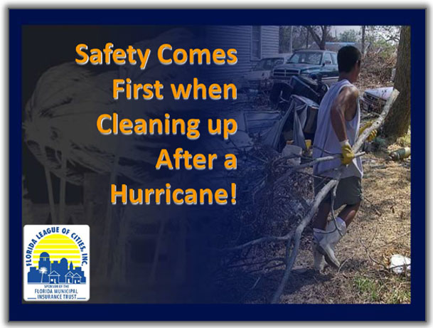
  • Please Ensure That Recovery Operations Are Undertaken Safely. Click Here to download an Overview of Post Event Safety.

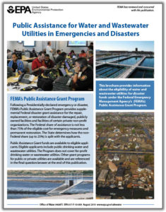
Click on the Following FEMA Public Assistance FACT SHEETS Along With Other Materials for Additional Information to Support Your Response & Recovery Initiatives:

FMIT Alert Level 1:
Low

Hurricane Maria Remains a Powerful Category 3 Hurricane After Making Landfall in Puerto Rico And Begins to Take a Northern Turn. Current Model Projections Predict Maria Continuing to Turn North And Passing Well to the East of Florida. This Will Be The Last FMIT Alert for Maria Unless Models Change.

FMIT Member:
Thursday September 21, 2017

Latest from the National Hurricane Center:

“At 21/1200 UTC, Hurricane Maria is located near 19.9N 68.7W or about 82 nm NNW of Punta Cana, Dominican Republic. The present movement of Maria is northwest at 8 kt. The estimated minimum central pressure is 959 mb. Maximum sustained winds are 100 kt with gusts to 120 kt. Numerous strong convection is within 135 nm of the center. Scattered moderate to isolated strong convection is elsewhere within 175 nm of the center. The eye of Hurricane Maria will continue to pass offshore of the northeastern coast of the Dominican Republic today. Maria should then move near the Turks and Caicos Islands and the southeastern Bahamas tonight and Friday.”

(Courtesy http://www.nhc.noaa.gov/ and http://www.wunderground.com/)

FMIT Discussion:

  • Maria made direct impact in Puerto Rico yesterday and is beginning to affect the Dominican Republic as a CAT 3 Hurricane.
  • Maria has maximum sustained winds of 115mph.
  • Current models continue to show a very small possibility of Maria impacting the Eastern Coast of Florida, with the center of the projected path recurving into the Atlantic prior to any landfall in Florida. This will be the last alert unless the models indicate a higher chance of impacting Florida.
  • After passing near the Dominican Republic today, Maria will approach the Turks and Caicos and southeast Bahamas tonight.
  • Maria is likely to bring high surf and rip currents to the U.S. East Coast starting this weekend.

FMIT Member Preparedness Actions:

  • Members should continue to monitor Hurricane Maria as well as FMIT Alerts and local/national weather forecasts.

Damage Reporting Options:

  • Call 844-FMIT-CAT (844-364-8228) to report any losses to your insured property and activate the FMIT Turnkey Recovery program for immediate response to any property losses you may have incurred. Also:
  • Go online: http://insurance.flcities.com and login to your account and submit your loss notice(s). FMIT and Synergy are immediately notified of your loss submittal.
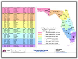
  • County Emergency Managers List – For additional contact information about your county, please Click Here.
Hurricane Maria
CAT 3
WIND:
115 MPH
Barometer:
960 mb
Current Movement:
9 MPH

Current Atlantic Tracking Map

FMIT Post Event
Recovery Safety
Click To View

FEMA Public Assistance
Fact Sheet
Click To View

TrackDown Application
Installation & User Guide
Click To View

FEMA PA Fact Sheet Eligibility
of Building Safety Inspections
Supporting Emergency Work
Click To View

9523-2-eligibility-of-building-safety-inspections-supporting-emergency-work-01-28-08-1

FEMA PA
Fact Sheet Labor Costs for
Emergency Work
Click To View

fema-pa_recovery-policy_eligible-labor-cost-2

FEMA PA
overview for Water
& Waste Water Plants
Click To View

fema-pa-for-wwp-eligibility-fact-sheet-1

Webinar Powerpoint
Slide Deck
Click To View

County Emergency Managers
Contact List
Click To View

FMIT Alert Archive – Click Here

FMIT ALERT RATING SYSTEM

FMIT ALERT

RATING SYSTEM

In order to give Members a clearer decision path for responding to alerts, FMIT will begin using a new alert rating system. The rating system will be based upon a combination of data that takes into account the following factors with regard to a weather event: Current NOAA Data, Relative Proximity to Florida and Predicted Path & Intensification Data from various sources. We will use a 5-number rating system in ascending order of intensity (similar to how hurricane intensity is rated) in order to help you determine how you should respond to alert information. The numbering system will work as follows:

LEVEL 1
LOW
Alert will provide information to FMIT Members in the entire state of Florida.  This level will provide information about tropical weather with a very low potential of affecting Florida within 7 days.  This will include tropical waves with a low chance of development as well as tropical storms and hurricanes that are 7+ days away from Florida with a very small chance of affecting Florida based upon NOAA and model predictions*.  These alerts may also include other weather events that Members should be aware of, but for which Members should not have direct, immediate concern.
*In some cases, we may decide to withhold Level 1 alerts for tropical events developing in areas that have little-to-no immediate potential for impacting Florida.
Member Response: Awareness
LEVEL 2
LOW-MODERATE
Alert will provide information to FMIT Members in the entire state of Florida.  This level will provide information about tropical weather with a low-moderate potential of affecting Florida within 5 days.  This will include tropical waves with a moderate chance of development as well as tropical storms and hurricanes that are 5 days away from Florida with a low-moderate chance of affecting Florida based upon NOAA and model predictions*.  These alerts may also include other weather events that Members should be aware of, but for which Members should not have direct, immediate concern.
*In some cases, we may decide to withhold Level 2 alerts for tropical events developing in areas that have little-to-no immediate potential for impacting Florida.
Member Response: Awareness & Limited Action (Possible communication with internal Disaster Preparedness Team Members as to Knowledge of Weather Event)
LEVEL 3
MODERATE
Alert will provide information to FMIT Members in the entire state of Florida.  This level will provide information about tropical weather with a moderate potential of affecting Florida within 3-5 days.  This will include tropical waves with a moderate-high chance of development as well as tropical storms and hurricanes that are 3-5 days away from Florida with a moderate chance of affecting Florida based upon NOAA and model predictions.  These alerts may also include other weather events that Members should be aware of with moderate concern.
Member Response: Awareness & Action with Stakeholders (Potential implementation of Disaster Preparedness Plans)
LEVEL 4
MODERATE-HIGH
Alert will provide information to all FMIT Members within and in the vicinity of the 5-Day Forecast Cones issued by NOAA.  This level will provide information about Tropical Storms and Hurricanes with a potential to impact parts of Florida within 24 hours.   These alerts will come in with the “High Priority” setting in Microsoft Outlook used to alert Members of the importance of the email.  After a Level 4 Alert, Members in the 5-Day Forecast Cones will receive communications from the FMIT Recovery Program Manager in order to ensure that the following are reviewed:  Emergency Contacts, Critical Assets, Member Expectations/Requirements, Pre-Staging of Assets, etc…
Member Response: Awareness, Implementation of Disaster Preparedness Plans, Communications with FMIT Recovery Program Manager (Members should be actively preparing for the possibility of an event in their area)
LEVEL 5
HIGH
Alert will provide information to all FMIT Members in the potential 3-Day/5-Day Forecast Cones issued by NOAA.  This level will provide information about Tropical Storms and Hurricanes with a potential to impact Florida within 1-3 days.   These alerts will come in with the “High Priority” setting in Microsoft Outlook used to alert Members of the importance of the email.  After a Level 5 Alert, Members in the Forecast Cones will receive communications from the FMIT Recovery Program Manager in order to finalize disaster preparations, contact Emergency Contacts, confirm pre-staging of Assets and FMIT Rapid Damage Assessment personnel, establish Post-Event Meeting Locations,  etc…
Member Response: Awareness, Execution of Disaster Preparedness Plans, Communications with FMIT Recovery Program Manager (Members should be making final preparations for the possibility of an event in their area)
Share

You also might be interested in

FMIT Alert Level 3: Tropical Storm Nate Currently North of Honduras in Caribbean; Projected to Become a Strong Tropical Storm/Weak Hurricane Before Making Landfall As CAT 1 Hurricane Around New Orleans Early Sunday Morning. 10-06-17

Oct 6, 2017

FMIT MEMBER EMERGENCY CONTACT FORM REGISTER HERE FMIT MEMBER EMERGENCY CONTACT FORM[...]

FMIT Alert Lvl 1 – Tropical Storm Dorian Forms East of The Lesser Antilles. Possible Strengthening Into Hurricane And Interaction With FL Next Week 8-25-19

Aug 26, 2019

To Sign Up For FMIT Alerts CLICK HERE To Sign[...]

FMIT Alert Lvl 3: TS Gordon Forms in Upper FL Keys This Morning 9-3-18

Sep 3, 2018

FMIT MEMBER EMERGENCY CONTACT FORM REGISTER HERE FMIT MEMBER EMERGENCY CONTACT FORM[...]

TurnKey Recovery
Contact Information
  • SynergyNDS
  • 1400 Sarno Rd Melbourne, FL 32935
  • 888.580.7080
Links

Florida League of Cities
simpliCity
Florida Municipal Insurance Trust
Synergy ID

TrackDown℠ Mobile Application


Get it on Google Play


Download on the App Store
Click For More Information
simpliCity
Managed Vendor Program

© 2025 — SynergyNDS

  • Home
  • FMIT Members
  • TMLIRP Members
  • MVP Vendor Registration
Prev Next