There are no impending weather events at this time.
FMIT Alert:
Hurricane Irma Recovery Update
3+ Weeks from Landfall
-
Members who have not reported damages or had Damage Assessments performed, should report any and all damages to Member-owned property caused by Irma to FMIT as soon as possible.
-
The period for receiving a complimentary Damage Assessment of known damages to your insured assets is coming to an end. The purpose of these assessments is to document the post-loss condition of damaged assets. While not a formal adjustment, these assessments streamline the assigning of an adjuster and are used for reporting damages to insurance and documenting for potential Public Assistance purposes. Email irma@flcities.com to request a Damage Assessment along with a list of damaged locations/assets for us to review.
-
Alternatively, you can email irma@flcities.com directly with your claim information related to damaged covered property and covered vehicles. Please note the Damage Assessment method is the most effective and efficient method of claim reporting since it syncs with FMIT’s claims system. Either way your claim-related communications will be addressed as quickly as possible.
-
Adjusters have been visiting Member locations this week as FMIT is currently deploying a state-wide rollout of insurance adjusters.
-
Adjustment teams should be contacting you to schedule your site visits over the coming days.
-
Adjustment teams are focused on visiting losses to buildings and larger structures. Some of these may be at secure facilities, such as water plants. Please ensure the appropriate personnel are available when scheduling site visits..
-
Irma caused widespread minor damages to many scheduled buildings and structures. With the application of the Named Storm Deductible (NSD) as standard part of municipal insurance programs in Florida, for this event deductibles change from the per occurrence P&C deductible (found on the Declarations Page) to the Named Storm Deductible, which is calculated using a percentage (typically 2%, 3%, or 5%) that is multiplied by the scheduled value of each building/structure. In effect, each scheduled asset will have its own deductible.
-
Due to the application of the NSD for wind-related damages, unfortunately many covered member damages to scheduled buildings and structures will fall below the deductible threshold for receiving insurance proceeds.
-
Members will need to manage the recovery of the below-deductible losses assets directly as they would not be eligible for FMIT Turnkey Recovery program unless the Member has a contract with SynergyNDS, Inc. to perform recovery of assets below deductible. This is to protect FMIT Members from potential issues with FEMA public assistance when using a Recovery Program Manager for under-deductible losses.
-
We know that many Members have also experienced damage to Property in the Open (PITO), such as fencing, lighting, playground equipment, etc.
-
Covered PITO is addressed in a special endorsement in the 2016-17 policy. Covered PITO must not be excluded in the PITO Endorsement and must be located at a scheduled location in the policy.
-
Damages to PITO covered under the Endorsement are subject to a PITO sublimit (found on the Dec Page of the FMIT Policy) with a minimum limit of $100,000 per Member).
-
The named storm deductible for PITO is triggered when damage amounts to all covered real property (building, structures, property in the open) exceed the Member’s P&C Deductible for Real Property (found on the Dec Page of the FMIT Policy). Once triggered, the PITO deductible is calculated by multiplying the Named Storm Deductible Percentage in your Named Storm Deductible Endorsement (typically 2% ,3% or 5%) by the actual recovery cost of the covered PITO damages.
-
Example: Member P&C Deductible is $25,000 and NSD is 3%
-
Assume: Damage to scheduled buildings/structures > $25,000
-
Assume: Covered PITO damages of $50,000
-
PITO Deductible: 3% multiplied by $50,000 = $1,500
-
FMIT Anticipated Proceeds: $50,000 – $1,500 = $48,500 (97%)
-
While most PITO is included in the Endorsement, the following assets are not covered and would need to be scheduled separately in the Real & Personal property schedule in order to receive coverage:
-
Signs & Scoreboards (excl. signs attached to buildings)
-
Pavilions & Shade Structures
-
Non-Fixed Assets (portable shade structures, trash cans, etc.)
-
Pumps
-
Please review the PITO Endorsement for more information
-
When repairing covered PITO damages, ensure that you are documenting a photo of the damages and keeping track of all costs incurred by your organization (overtime hours for salaried staff, hourly rates paid to subs, invoices for repairs, etc…) as these will need to be submitted to FMIT for reimbursement.
-
While much of the damage caused by Irma is covered under the FMIT policy, most of Irma’s damage to Member buildings and larger structures will fall well below the Named Storm Deductibles triggered when Irma made landfall as a named storm in Florida.
-
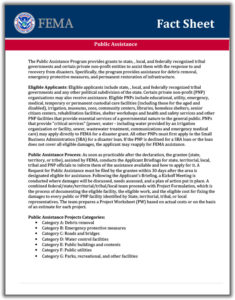
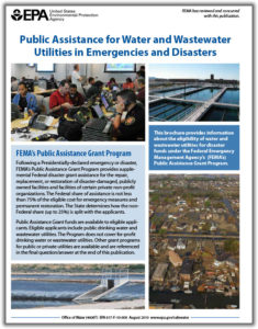
Members can apply for reimbursement for repairs to these damages by applying for federal public assistance through the Federal Emergency Management Agency (FEMA).
-
Members need to ensure that they are following their internal procurement procedures for making repairs to damages assets. If Members’ internal procurement procedures prior to Irma include expedited processes for critical assets damaged due to catastrophic events, those will likely be respected by FEMA.
-
The first step in applying for FEMA Public Assistance is to go to www.floridapa.org and apply. Follow the instructions and fill out the information in order to register in the system.
-
FEMA has a site that answers commonly asked questions located at: https://www.fema.gov/public-assistance-frequently-asked-questions
-
FEMA is currently busy responding to 3 major disasters (Harvey-TX, Irma-FL, Maria-PR). FMIT anticipates that this will somewhat delay the process. Once Members begin scheduling their Kick-Off meetings, they should notify FMIT using the propclaim@flcities.com email.
-
Many Members are facing issues related to debris removal. In nearly all cases, debris from trees or any vegetation knocked over or damaged by the storm is not covered under the FMIT Property Policy unless the debris is either:
a) contacting an insured asset, or
b) blocking immediate access to an insured asset & impeding recovery. -
Any Members that have or are seeking a debris management contractor should ensure that your agreements with said contractor include verbiage that indemnifies and remunerates your organization specifically from errors made by the contractor during the debris management process that would disqualify your organization from FEMA Public Assistance. We also strongly suggest you consult with your organization’s attorney prior to any procurement to assure compliance with any existing or emergency orders or directives applicable to debris removal, FEMA funding or the like.
-
We have been getting requests regarding Member trees that have fallen on citizens’ homes/property. In these cases, FLC will have to determine if the tree was dead or otherwise in a poor condition before rendering a coverage decision. In most cases this is an “act of God” that would not be the fault of the FMIT Member. It is the homeowner’s responsibility to remove the fallen trees on their property and to mitigate additional damages. Homeowners can be advised to file a claim with their homeowner’s insurance company.
-
This is a very popular question among FMIT Members. Through the FMIT PACT (Public Assistance Closeout Team), we have worked with FEMA and Members on previous de-obligations from ‘04/’05 storms as well as recent Hurricanes Hermine and Matthew. We will be supporting Member FEMA PA Applications and associated project worksheet development, where requested, in order to minimize potential issues. We will work with the FEMA PAC specialist to review the project worksheet to ensure that there is no potential duplication of benefits and that the claim has been adjudicated correctly. Information is already being captured in simpliCity under each Member’s claim to assist in the documentation process.
-
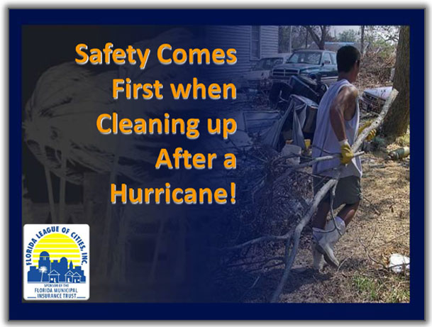
Please Ensure That Recovery Operations Are Undertaken Safely. Click Here to download an Overview of Post Event Safety.
-
FMIT will analyze coverage on every claim presented and render an adjudication and settlement for covered damages. FMIT recognizes that as owners of your property, you have the right to undertake repairs to your property as quickly as possible. If you begin repairing/replacing damaged assets, you must ensure that you first have a Damage Assessment performed or assure photos and descriptions of the damages are recorded and transmitted to nate@flcities.com. Without this information, your property damage claim may be jeopardized.
-
Report any and all damages to Member-owned property caused by Nate.
-
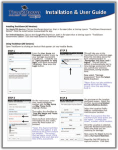
The best way to report damages is through the Trackdown Damage Assessment mobile application as damages are linked to existing assets and claims with photos and descriptions. FMIT offers free Damage Assessments to Members who request them and provide a list of damaged locations for us to visit. Email propclaim@flcities.com to request a Damage Assessment along with a list of damaged locations/assets for us to review. These Damage Assessments will also allow us to direct resources to your affected locations.
-
Alternatively, you can email nate@flcities.com directly with your claim information related to damaged covered property and covered vehicles. Please note the Damage Assessment method is the most effective and efficient method of claim reporting since it syncs with FMIT’s claims system. Either way your claim-related communications will be addressed a quickly as possible.
-
If you have reported damages to covered property to FMIT, we will deploy an adjuster to your affected location(s). An adjuster will contact you to schedule the site visit as they are assigned by FMIT.
-
Some Members are facing issues related to debris removal. In nearly all cases, debris from trees or any vegetation knocked over or damaged by the storm is not covered under the FMIT Property Policy unless the debris is either:
a) contacting an insured asset, or
b) blocking immediate access to an insured asset & impeding recovery. -
Any Members that have or are seeking a debris management contractor should ensure that your agreements with said contractor include verbiage that indemnifies and remunerates your organization specifically from errors made by the contractor during the debris management process that would disqualify your organization from FEMA Public Assistance. We also strongly suggest you consult with your organization’s attorney prior to any procurement to assure compliance with any existing or emergency orders or directives applicable to debris removal, FEMA funding or the like.
-
We have been receiving questions regarding Members’ trees that have fallen on citizens’ homes/property. In these cases, FLC will have to determine if the tree was dead or otherwise in a poor condition before rendering a coverage decision. In most cases this is an “act of God” that would not be the fault of the FMIT Member. It is the homeowner’s responsibility to remove the fallen trees on their property and to mitigate additional damages. Homeowners can be advised to file a claim with their homeowner’s insurance company.
-
We don’t anticipate FEMA being a big actor in the Nate recovery. If Public Assistance is available to members, the FMIT can support Member FEMA PA Applications and associated project worksheet development, where requested, in order to minimize potential issues. We will work with the FEMA PAC specialist to review the project worksheet to ensure that there is no potential duplication of benefits and that the claim has been adjudicated correctly. Information is already being captured in simpliCity under each Member’s claim to assist in the documentation process.
-
If applicable, Members are advised to contact SynergyNDS, Inc. (FMIT PACT Manager) after they have scheduled their individual FEMA Kickoff meeting. Synergy is currently setting up additional contact information for the FMIT PACT Team, which will be distributed in subsequent FMIT Alert emails.
Damage Reporting Options (Updated with Lessons Learned through Irma):
-
Call 844-FMIT-CAT (844-364-8228) to request Damage Assessments for your affected locations. FMIT learned through Irma that the Damage Assessment process offered through FMIT is the fastest way to identify and report damages to FMIT. Once you receive reports of initial damages, if any, FMIT will deploy personnel to your organization to capture those losses using Trackdown, FMIT’s proprietary Damage Assessment mobile application.
-
You can also choose to perform your own Damage Assessments using Trackdown. You can go to the Google PlayStore (for Android Devices) or the Apple AppStore (for Apple devices) and search for, “Trackdown – Government Edition” and install it on your device(s). FMIT will be sending out Trackdown login information to Members in the potentially affected area over the next 48 hours.
-
Alternatively you can go online: http://insurance.flcities.com and login to your account and submit your loss notice(s). While FMIT and Synergy are immediately notified of your loss submittal, it may delay the response and recovery process as the loss information for each asset is not captured automatically into our system.
-
While not encouraged due to the increased processing time for Members and FMIT, Members can email damages due to Nate to nate@flcities.com. This may increase the processing time for your claim as this information will need to be entered into simpliCity manually.
Latest from the National Hurricane Center:
“Hurricane Nate is centered near 24.5N 87.0W at 07/0900 UTC or
about 297 nm south-southeast of the mouth of the Mississippi
river. Nate is moving north-northwest at 19 kt. Estimated minimum
central pressure is 987 mb. Maximum sustained wind speed is 70 kt
with gusts to 85 kt. Numerous strong convection is from 23N-25N
between 85W-88W. Scattered moderate to isolated strong convection
and tstms are elsewhere from 17N-29N between 82W-92W.”
FMIT Alert Lvl 4:
Moderate/High
Tropical Storm Michael Forms in The Northwestern Caribbean Late in The Weekend and is Expected to Strengthen Further Into a Hurricane.
Michael is Projected to Make Landfall as a CAT 2 Hurricane in The Florida Panhandle/Big Bend Area on Wednesday. Outer Bands Begin to Affect South Florida Today.
Hurricane Watches Have Been Issued For the Panhandle And Big Bend Areas. Tropical Storm Watches Have Been Issued For The Western Coast of Florida.
FMIT is Activating the CAT Room in Orlando & Mobilizing Ride-Out Teams to The Panhandle & Big Bend to Support FMIT Members’ Response Initiatives.
FMIT Discussion:
8:30 AM EST Monday October 8, 2018
-
FMIT activating pre-event emergency response procedures in preparation for anticipated landfall of Michael along the Gulf Coast and Big Bend area of Florida mid-week.
-
FMIT CAT Room in Orlando activating Tuesday to support Members’ claim submittals & direct deployment of potential mitigation services.
-
FMIT Ride-Out Teams currently deploying along the Panhandle and Big Bend area.
-
FMIT expects many FMIT Members in the Peninsula will experience heavy rains and up to Tropical Storm-force winds as Michael moves north. West Coast & Gulf Coast members can expect to experience storm surge & higher winds over the next 24-72 hours.
-
At this time, the eye of Hurricane Michael is expected to make landfall late Wednesday night or early Thursday morning.
-
FMIT will continue to monitor Tropical Storm Michael and send additional alerts as the storm approaches Florida.
FMIT Member Preparedness Actions:
-
Members should be communicating with internal emergency response leadership regarding potential wind or rain damage that may occur.
-
Members who have not already submitted their recovery expectations to Synergy should download a copy of the FMIT Expectations Document for review and submittal back to Synergy in order to clearly identify when and how you would like to use FMIT’s Turnkey Recovery Program by Clicking Here
-
If you do not currently receive FMIT Alerts and would like to be on the FMIT Emergency contact list, click the red button below and fill out the necessary information to subscribe. Additionally, you can forward this alert email to individuals who may benefit and they can sign up by Clicking Here.
Latest from the National Hurricane Center:
“Michael has become better organized this morning, with the deep
convection migrating westward on top of the low-level center and
upper-level outflow beginning to increase within the western
semicircle. An Air Force Reserve Hurricane Hunter aircraft made
several passes through the system during the past few hours, and
somewhat surprisingly, found that the central pressure has fallen
to about 983 mb and maximum winds have increased to near 60 kt.
This increase in intensity indicates that despite the shear which
has been affecting Michael, the system has, by definition, rapidly
intensified during the past 24 hours.
With the increase in the initial wind speeds, the official
intensity forecast is higher than in the previous forecast.
Decreasing vertical shear and very warm sea surface temperatures
are expected to support continued strengthening, and due to the
favorable conditions, the NHC intensity forecast follows a blend of
the IVCN consensus and the HCCA model. This new official forecast
brings the intensity to just below major hurricane strength in 48
hours, and since the storm will still be over water for a time
between 48 and 72 hours, there is a real possibility that Michael
will strengthen to a major hurricane before landfall. Weakening is
expected after landfall, but the system will likely maintain
tropical storm strength after day 4 when it moves off the east
coast of the United States. Michael should then become an
extratropical low by day 5.“
(Courtesy https://www.nhc.noaa.gov/ )


Tropical Storm
Michael
Current Atlantic Tracking Map

Fact Sheet
Installation & User Guide
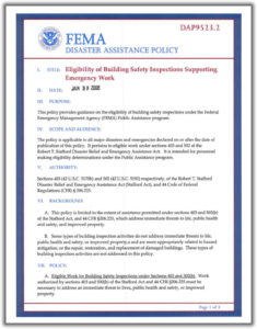
of Building Safety Inspections
Supporting Emergency Work


FMIT ALERT RATING SYSTEM
FMIT ALERT
RATING SYSTEM
In order to give Members a clearer decision path for responding to alerts, FMIT will begin using a new alert rating system. The rating system will be based upon a combination of data that takes into account the following factors with regard to a weather event: Current NOAA Data, Relative Proximity to Florida and Predicted Path & Intensification Data from various sources. We will use a 5-number rating system in ascending order of intensity (similar to how hurricane intensity is rated) in order to help you determine how you should respond to alert information. The numbering system will work as follows: