FMIT Alert Level 2:
Low-Moderate
Low-Moderate
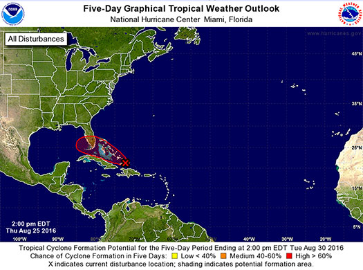
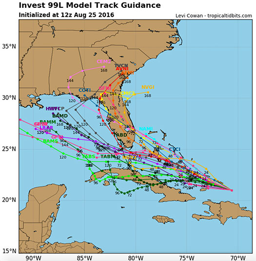
Tropical Disturbance 99L Weakens Slightly as it Moves Northwest Through The Caribbean.
Potential Still Exists For Interaction With Florida Later This Weekend.
3:00 pm EST, Thursday, August 25, 2016
Latest from the National Hurricane Center:
“A broad area of low pressure associated with a tropical wave is moving westward at 15 to 20 mph through the southeastern Bahamas. Satellite wind data and reports from an Air Force Reserve reconnaissance aircraft this morning indicate that the system still lacks a closed circulation, and that the strongest winds associated with the system likely have decreased to below tropical storm strength.”
FMIT Ride-Out teams will remain on standby through the end of the week into the weekend as the path and strength of the disturbance become more clear. Future alerts will be sent daily and then multiple times per day as it approaches Florida. Should the storm develop significantly, we will arrange pre-event webinars and calls to educate Members on FMIT’s mitigation and response procedures.
Storm Imagery (Courtesy www.nhc.noaa.gov/ and www.tropicaltidbits.com/ )