• Home
  • FMIT Members
  • TMLIRP Members
  • MVP Vendor Registration

Call us today! 888.580.7080

Our Location
simpliCity Login
SynergyNDSSynergyNDS
SynergyNDS is a leading Recovery Program
Manager for Public Entities with combined current
insured property in excess of $68 billion dollars.
synergynds, synergy recovery of florida, florida league of citiesSynergyNDS, Synergy Recovery of Florida, Florida League of CitiesSynergyNDS, Synergy Recovery of Florida, Florida League of CitiesSynergyNDS, Synergy Recovery of Florida, Florida League of CitiesSynergy Recovery of Florida, SynergyNDS, Florida League of Cities
  • Home
  • FMIT Members
  • TMLIRP Members
  • MVP Vendor Registration

Trailing bands of Colin bring more wind and rainfall to FL into Tuesday 6-7-16

FMIT Alert Level 4:
Moderate-High
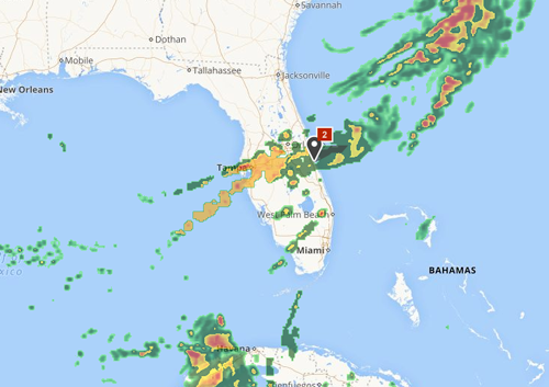
Trailing bands of Tropical Storm Colin to bring more wind and rainfall to Florida into Tuesday
9:00 am EST, Tuesday, June 7, 2016

Latest from the National Hurricane Center:

“Tropical Storm Colin is located about 110 miles northeast of Jacksonville, Florida, and is moving to the northeast at 31 mph as of 5 a.m. EDT Tuesday. Maximum sustained winds are around 50 mph as of Tuesday morning, though the strongest winds are in offshore waters. Tropical storm warnings remain in effect from Altamaha Sound, Georgia, to Oregon Inlet, North Carolina. High surf and dangerous rip currents remain a threat along the Southeast coast Tuesday, from Florida to North Carolina.”

FMIT has mobilized Ride-Out teams to potentially affected areas. Heavy rain and flooding is possible Monday through Wednesday across areas of the state. Call 855-FMIT-LOSS (855-364-8567, Option 3) to report any losses to your insured property and activate the Turnkey Recovery program.
Storm Imagery (Courtesy www.weather.com )


colin-6-7-16
Share

You also might be interested in

FMIT Alert Lvl 2 – FMIT Continuing to Monitor Invest 98L as it Approaches East FL Coast – Now Given Medium Chance of Development Over The Weekend 8-23-19

Aug 23, 2019

To Sign Up For FMIT Alerts CLICK HERE To Sign[...]

FMIT Alert Lvl 1 – FMIT Currently Monitoring Invest 95L Located Northwest of Hispaniola. Possible Development as it Moves Towards FL 9-11-19

Sep 11, 2019

To Sign Up For FMIT Alerts CLICK HERE To Sign[...]

Irma Remains a Powerful CAT 5 Hurricane With Winds of 180 mph. Florida Still Within Center of 3-Day Forecast Cone With The Projected Path of The Hurricane Remaining More Towards The East. Additional Mandatory Evacuations Issued For The Majority of South Florida. 9-7-17

Sep 8, 2017

FMIT Alert Level 5 High Irma Remains a Powerful CAT[...]

TurnKey Recovery
Contact Information
  • SynergyNDS
  • 1400 Sarno Rd Melbourne, FL 32935
  • 888.580.7080
Links

Florida League of Cities
simpliCity
Florida Municipal Insurance Trust
Synergy ID

TrackDown℠ Mobile Application


Get it on Google Play


Download on the App Store
Click For More Information
simpliCity
Managed Vendor Program

© 2026 — SynergyNDS

  • Home
  • FMIT Members
  • TMLIRP Members
  • MVP Vendor Registration
Prev Next